BestWaterfalls
Six very different reasons to travel for falling water: broad cataract systems, a towering tepui drop, easy viewpoints and a rare sunset effect. Filter by experience, then compare the access and season—not incompatible record claims.
No matching place. Clear the search or change the country, continent or trip type.
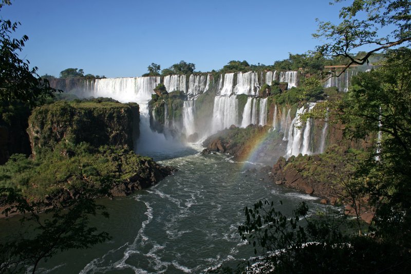
Iguazú Falls
Argentina / Brazil · Broad cataract system
Details & links
Hundreds of cascades spread across a rainforest border rather than one vertical plume. Argentina brings close-up walks; Brazil offers the broader panorama. The quoted 2.7 km describes the whole semicircular system, not one uninterrupted curtain. Floods can close boardwalks and boat excursions are optional, not required for the main views. Check park notices and border entry requirements before visiting both sides.
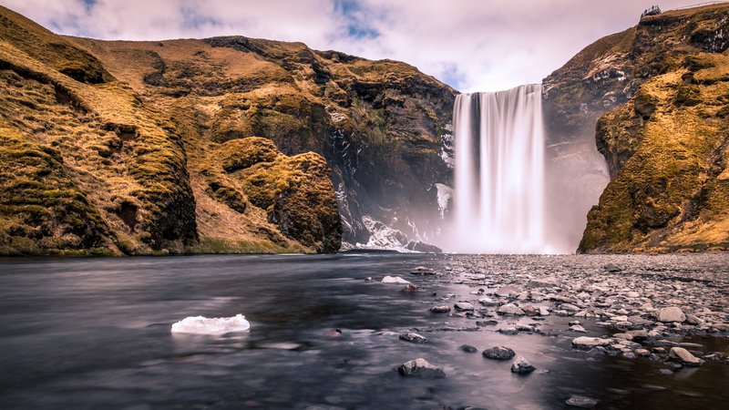
Skógafoss
Iceland · Big waterfall, straightforward stop
Details & links
A substantial South Coast waterfall with a close base view, often reached on a road trip from Reykjavík. Allow a long driving day rather than treating it as a city-centre stop. The Icelandic environment authority documents the 60 m drop; no comparable width measurement is given in that source. The upper viewpoint is optional. Spray, icy ground and strong wind demand caution; stay on marked paths and check road conditions.
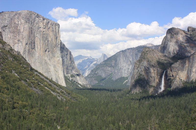
Bridalveil Fall, Yosemite
United States · Granite valley & windblown spray
Details & links
A short paved walk gives a close view without the strenuous ascent required by some other Yosemite waterfalls. It flows year-round; spring and early summer produce the strongest spray. The National Park Service gives 620 ft / 189 m for the drop. Stay on the paved trail: rocks beyond the viewing area are dangerously slippery. The photograph is the wider Tunnel View panorama, with Bridalveil at the right, not a close-up of the trail.
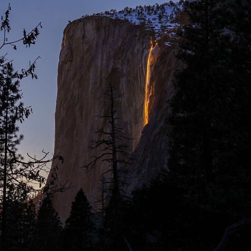
Horsetail Fall, Yosemite
United States · Rare sunset backlighting
Details & links
The reason to come is a fleeting optical effect, not a flow or height record. Water, a clear sunset and the February sun angle must coincide for an orange glow; nothing is guaranteed. The park normally requires a substantial walk from designated parking and manages crowds with temporary road restrictions. Consult the current year's official page before planning: February 2026 arrangements are not a promise for 2027.
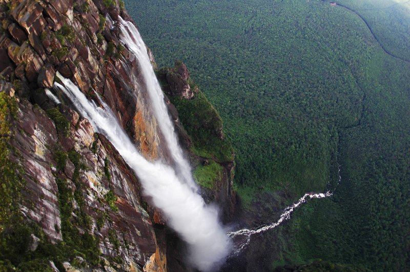
Angel Falls, Canaima
Venezuela · Tepui height & expedition access
Details & links
A remote waterfall dropping from a tepui, not a roadside viewpoint. UNESCO identifies the park's roughly 1,000 m waterfall as the world's highest; published measurements differ in rounding and what is counted. Access depends on charter flights, navigable water, weather and a reputable local operator, usually over several days. Security and healthcare risks can outweigh access: review your government's current Venezuela advisory before considering travel, and confirm routes independently.
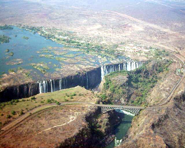
Victoria Falls / Mosi-oa-Tunya
Zambia / Zimbabwe · Wide curtain & roaring gorge
Details & links
A vast Zambezi curtain spanning two countries. February–May high water brings heavier spray that can hide parts of the view; later dry-season flows shrink and some Zambian sections may dry out. June–August is a practical balance, not a guaranteed optimum. Visit the official park viewpoints first; helicopter trips and river activities are separate extras. Allow for border formalities if combining both sides and keep away from unfenced river edges.
Planning notes & sources
- Heights and widths describe different things: an overall cascade, maximum drop, river frontage or semicircular system. These are not a like-for-like ranked table. Where an official source gives no comparable measurement, the card says so rather than inventing one.
- Season windows are planning guidance, not water-flow guarantees. Check park closures, roads, current weather and viewing restrictions; swimming near falls and scrambling over wet rocks are not part of these recommendations.
- Angel Falls is included for geographical significance, not as an unconditional travel recommendation. Read the current U.S. Venezuela advisory or your own government’s advice before booking; access and security conditions can change.
- Official tourism, park and route sources are linked on the cards. Reviewed 19 September 2026. Photographs are existing locally hosted Wikimedia assets; credits identify the original file and licence. Regional photographs illustrate the setting, not a guaranteed view or exact route alignment.