From Hotel: 🚕 10 min → High Desert Museum
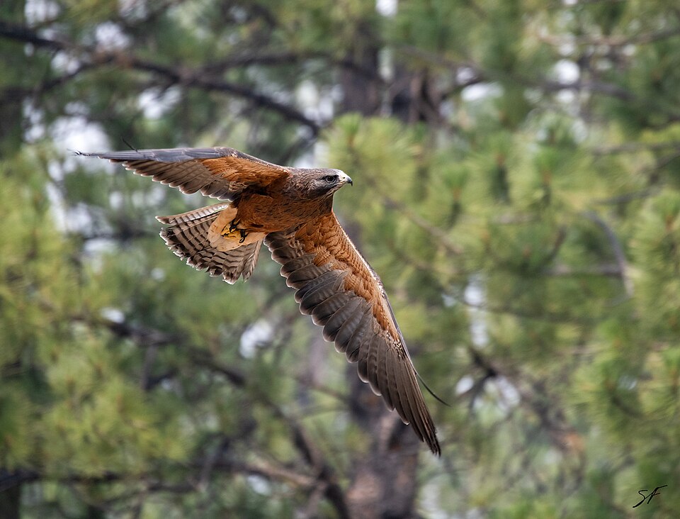
A 135-acre natural history campus in the ponderosa pines south of Bend, bringing the high desert to life with live river otters, raptors, and porcupines alongside 19th-century settler cabins and rotating gallery exhibitions. The outdoor wildlife loop and historical trail run about two hours end-to-end.
🏛️ Daily 9:00am - 5:00pm
⏰ ~2 hr
⚠️ Closed in January and February — verify dates before visiting in winter.
🚶 15 min · 🚕 5 min → Lava Butte
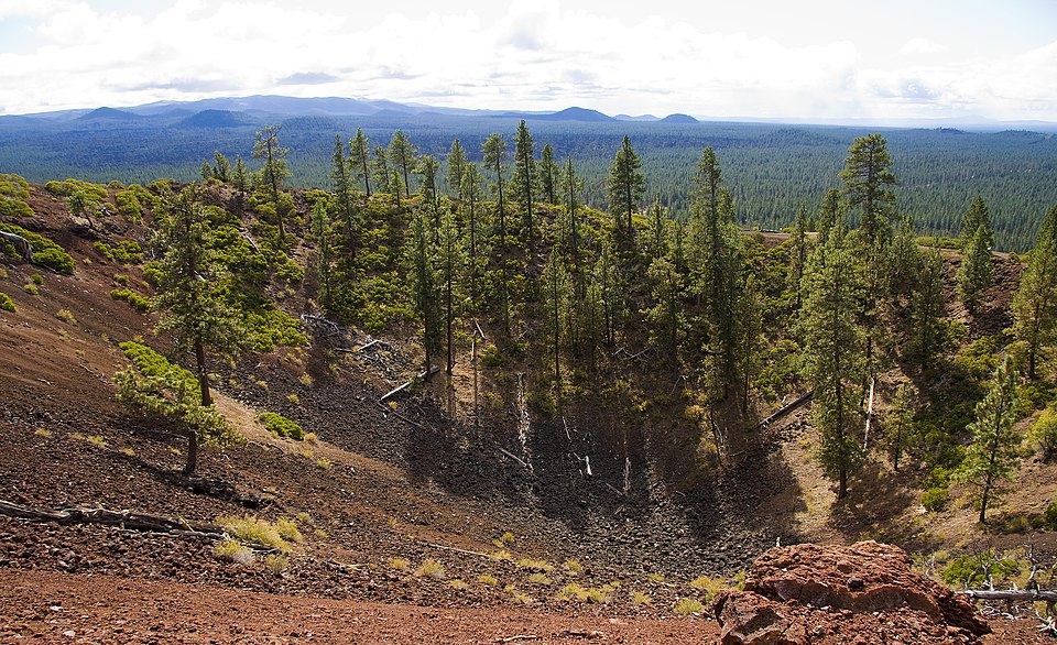
A 500-foot red cinder cone that erupted about 7000 years ago, ringed by the black basalt of the Lava Lands flow. A road spirals to the rim, where a lookout tower and crater trail open onto a sweep of Cascade peaks and the high-desert lava plain below.
🏛️ Daily 9:00am - 5:00pm
⏰ ~1.5 hr
⚠️ The visitor center and summit road open May 15 through September 15 only.
⚠️ Mid-June to early September the summit road is reached by shuttle from Lava Lands Visitor Center only — no personal vehicles allowed during shuttle hours.
🚶 15 min · 🚕 5 min → Lava River Cave
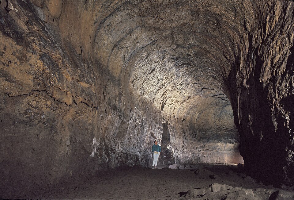
Oregon's longest lava tube at nearly one mile, carved by basalt flows over 80000 years ago. Walk through towering chambers and constricted passages with a rented lantern — a self-guided underground stretch that stays a steady 42 degrees no matter the season above.
🏛️ Daily 9:00am - 5:00pm
⏰ ~1.5 hr
⚠️ Open for the season May through September only.
⚠️ Timed-entry tickets sell out 2 - 3 weeks ahead in summer — book before your trip. No walk-up when sold out.
🚶 15 min · 🚕 5 min → Paulina Falls
A twin 80-foot waterfall where Paulina Creek pours over the rim of the Newberry Caldera. A short trail leads to an overlook at the lip and a second viewpoint at the base, where the two ribbons drop side by side into a rust-and-grey rock amphitheatre.
🏛️ Open 24/7
⏰ ~45 min
⚠️ Paulina Lake Road closes mid-November through late May under snow — the caldera is reachable only in the warm months.
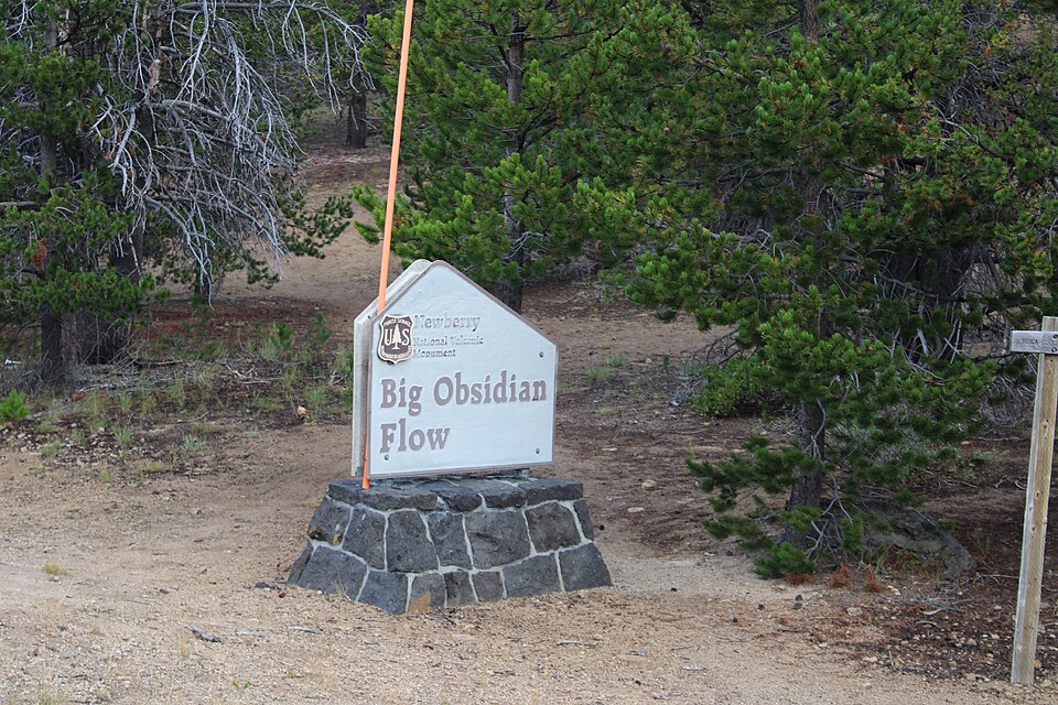
🚶 15 min · 🚕 5 min → Big Obsidian Flow
Oregon's youngest lava flow — about 1300 years old — a glittering mile-wide field of black volcanic glass and chalk-white pumice inside the Newberry Caldera. A one-mile interpretive loop climbs onto the flow itself, with Paulina and East Lakes spreading out below.
🏛️ Open 24/7
⏰ ~1 hr
⚠️ The trail climbs onto loose obsidian and pumice — stay on the path, and skip it in rain or snow when the glass turns slick.
🚕 55 min → hotel
From Hotel: 🚕 22 min → Pilot Butte State Scenic Viewpoint
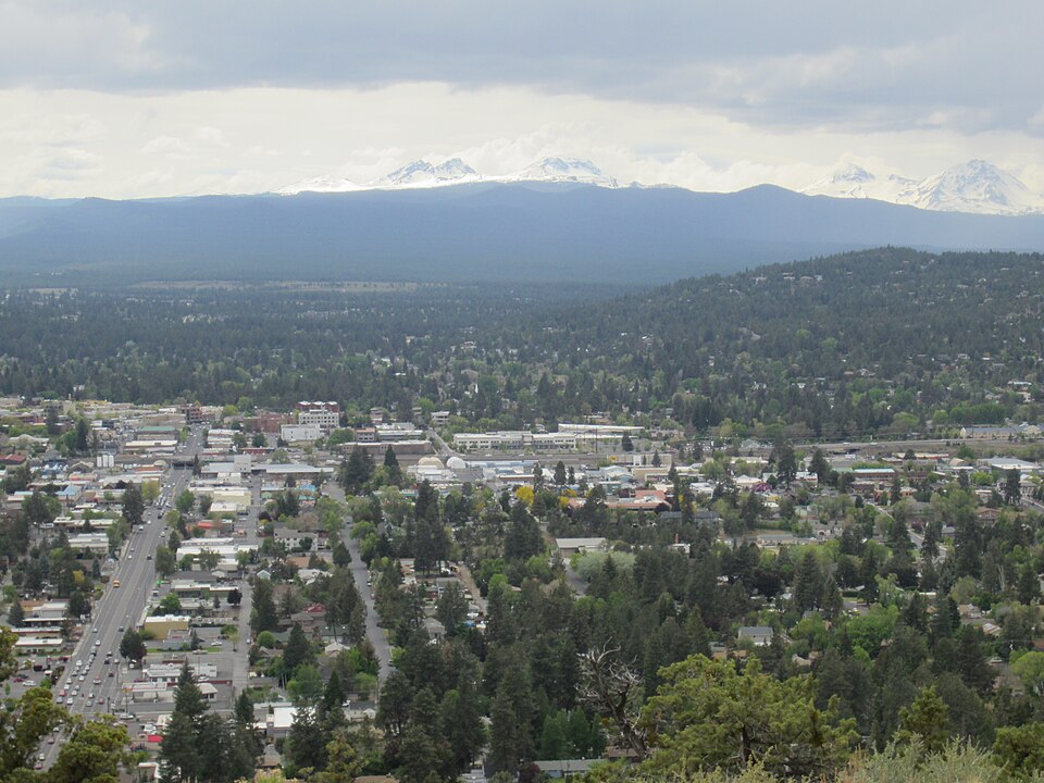
An extinct cinder cone rising 500 feet above Bend, offering an uninterrupted 360° panorama of nine Cascade peaks — Mt. Bachelor, South Sister, Broken Top, Mt. Jefferson, and more. Drive or hike the paved 1-mile summit trail.
🏛️ Daily 6:00am - 10:00pm
⏰ ~45 min
Free
⚠️ Summit road closed November through April.
🚶 15 min · 🚕 5 min → Smith Rock State Park
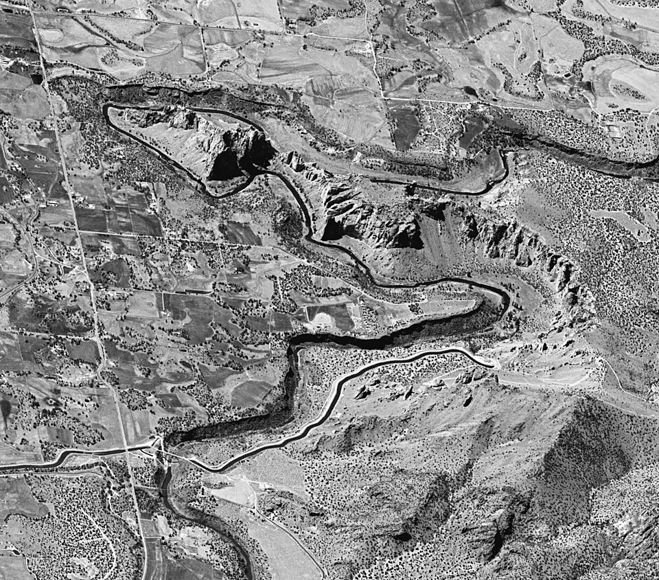
World-class basalt formations rising 650 ft above the Crooked River gorge. The 3.4-mile River Trail loops through cathedral spires, past Monkey Face column and Morning Glory Wall, with sweeping canyon views the entire way.
🏛️ Daily 6:00am - 10:00pm
⏰ ~3 hr
⚠️ Parking fills by 9:00am on summer weekends — arrive early or use the overflow lot north of the park.
🚶 15 min · 🚕 5 min → Peter Skene Ogden Viewpoint
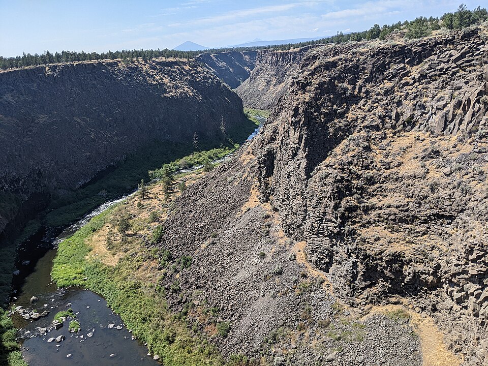
At Peter Skene Ogden State Scenic Viewpoint the Crooked River cuts a sheer 300-foot slot through the basalt, spanned by three historic bridges side by side. A short cliffside path runs to railed overlooks straight down into the gorge — dramatic and reached in minutes from the car.
🏛️ Open 24/7
⏰ ~30 min
⚠️ The rim is unfenced beyond the developed overlooks — the drop is sheer 300 feet, so keep back from the edge.
🚕 12 min → hotel
From Hotel: 🚕 38 min → Tumalo Falls
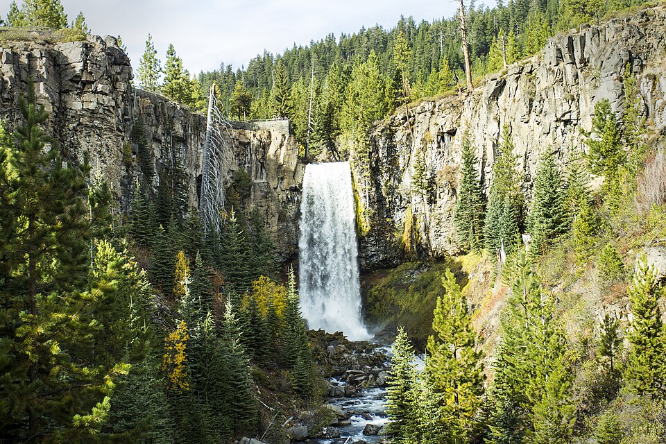
A 97-foot ribbon of water plunging into a narrow basalt canyon, reached by a 3.4-mile round-trip trail through ponderosa pines along Tumalo Creek. One of the most dramatic single-drop waterfalls in Central Oregon.
🏛️ Daily 8:00am - 8:00pm
⏰ ~2.5 hr
⚠️ Road closed November through May.
⚠️ Parking lot fills by 9:00am on summer weekends — arrive before 8:30am or after 3:00pm.
🚕 50 min → Sparks Lake
A shallow lava-dammed lake on the Cascade Lakes Scenic Byway, ringed by marsh and black lava and backed by Mt. Bachelor and South Sister. The mirror-still water at first light is the scene photographer Ray Atkeson made famous — the 2.5-mile shoreline loop hugs the view.
🏛️ Open 24/7
⏰ ~1.5 hr
⚠️ The Cascade Lakes Highway closes under snow late November through late May, and the gravel access road is rough for low-clearance cars in early summer.
🚕 8 min → Devils Lake
A tiny glacier-fed lake so clear and shallow it glows an unreal Caribbean turquoise over its white pumice bed. A few steps from the byway pullout deliver the whole scene — float, wade, or just stand at the shore and take in one of the most startling colors in the Cascades.
🏛️ Open 24/7
⏰ ~45 min
⚠️ On the Cascade Lakes Highway — closed under snow late November through late May along with the rest of the byway.
🚕 50 min → Benham Falls
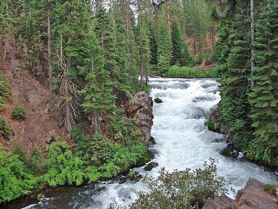
The Deschutes River squeezes through a narrow basalt channel and drops in churning cascades just north of Sunriver. A flat 2-mile round-trip trail through old-growth ponderosa pines leads to overlooks above the white water — an easy, dramatic finish to a day of Cascade alpine lakes.
🏛️ Open 24/7
⏰ ~1 hr
⚠️ The trailhead is reached via a short gravel road off Hwy 97 — closed under snow November through April.
🚕 12 min → hotel
🧗 The Wall That Changed American Climbing
Smith Rock State Park, just east of Bend, is where American sport climbing was born. In the early 1980s, climber Alan Watts began bolting routes on the park's volcanic tuff walls — a practice then controversial in a culture that prized uncertain protection. His ascents at Smith Rock, including the first free climb of Monkey Face, introduced bolt-protected sport climbing to the United States at a time when it existed mainly in Europe. The style spread from here across the country. The park's dramatic 550-foot columns of welded tuff are geologically unusual — remnants of ancient pyroclastic deposits — and their erosion-textured surface turned out to be nearly ideal for the technical face climbing that defines the sport today.
It is also worth noticing what created Bend's landscape in the first place: the Cascade rain shadow. The volcanic peaks to the west strip moisture from Pacific storms as they rise over the range, dropping heavy precipitation on the western slope while leaving the high desert east side — where Bend sits — receiving a fraction of that water. The result is roughly 300 sunny days a year, ponderosa pine forest instead of Douglas fir, and a climate that feels nothing like coastal Oregon despite being just a few hours inland.
_-_01.JPG)
_-_01.jpg)
.jpg)