From Hotel: 🚕 14 min → California Lighthouse
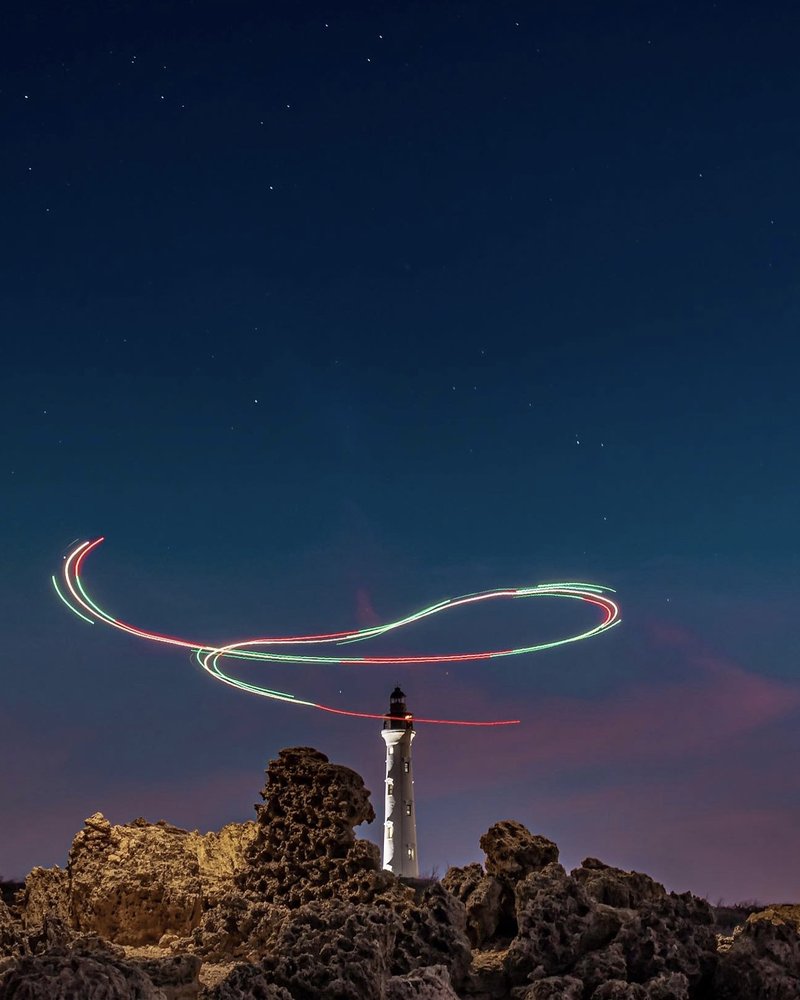
Aruba's most photographed landmark, built in 1916 at the rocky northern tip of the island. Climbing to the observation gallery rewards with a 360-degree panorama over the wild dune coast, the Arikok interior and the deep blue open Atlantic. Named after the SS California, a steamship that ran aground offshore in 1891.
🏛️ Daily 9:00am - 7:00pm
⏰ ~45 min
🚕 31 min → Fort Zoutman Historical Museum
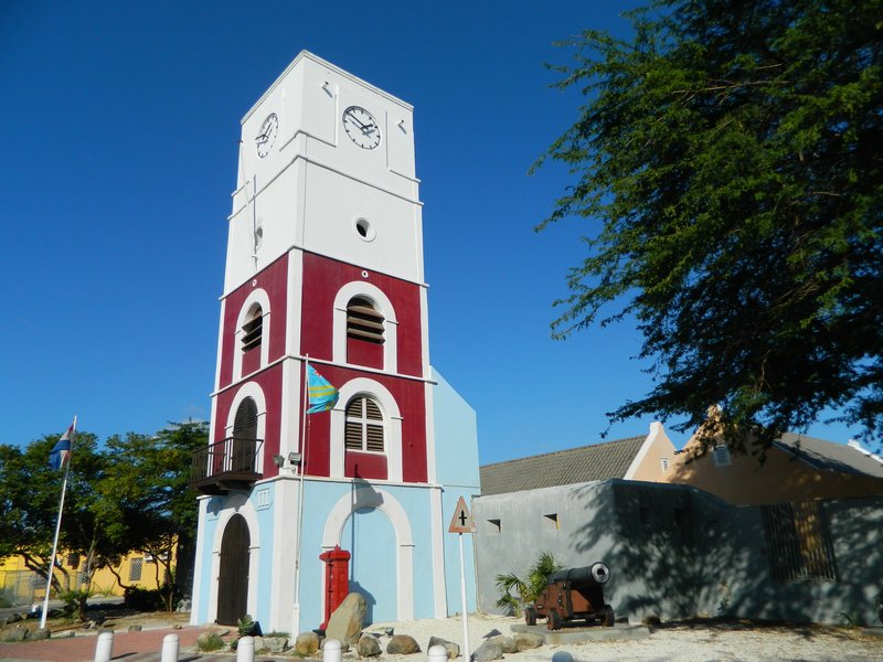
Aruba's oldest structure, built in 1798 to defend the coast. The Willem III Tower was one of the Caribbean's first lighthouses. Inside: pre-Columbian Caquetío artefacts, colonial memorabilia, geological displays and a record of the island's path to modernity.
🏛️ Monday - Friday 9:00am - 5:00pm · Saturday 10:00am - 2:00pm
🚫 Closed Sunday
⏰ ~1 hr
🚕 8 min → hotel
From Hotel: 🚕 35 min → Baby Natural Bridge
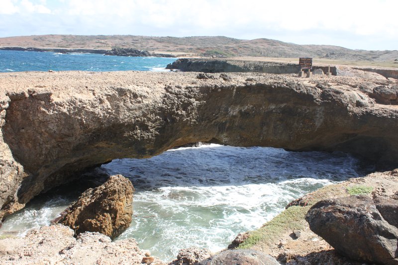
Aruba's remaining natural limestone arch, chiselled by Atlantic surf along the north coast near the Bushiribana gold smelter ruins. The original Natural Bridge collapsed in 2005. The Baby Bridge rises above the churning sea foam and makes one of the most photogenic coastal scenes on the island.
🚶 23 min · 🚕 6 min → Alto Vista Chapel
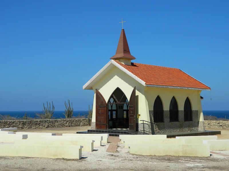
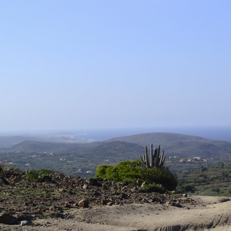
A petite sun-bleached chapel perched on a hilltop in Noord, built on the site of Aruba's first Catholic mission from 1750. Pilgrims still walk the Via Crucis — the Stations of the Cross — along the serpentine road up the hill. The view stretches across the pale cunucu scrubland to the distant sea in two directions.
🏛️ Daily 6:00am - 8:00pm
⏰ ~30 min
Free
🚕 9 min → Ayo Rock Formations
Enormous diorite boulders rising from Aruba's flat scrubland near the village of Ayo. Ancient Caquetío petroglyphs are carved into the rock faces and the formations are used for rock climbing. The surrounding cacti and wind-bent divi-divi trees make it one of the island's most otherworldly landscapes.
🚕 15 min → Arikok National Park
A 34-sq-km national park protecting nearly a fifth of the island. The landscape is arid: limestone cliffs, sea caves, wind-sculpted divi-divi trees and cactus forests. Two Caquetío cave sites — Fontein and Guadirikiri — lie just inside the gate. The park is the gateway to the Natural Pool.
🏛️ Daily 8:00am - 4:00pm
⏰ ~2 hr
⚠️ Last entry 3:30pm
🚶 29 min · 🚕 7 min → Natural Pool
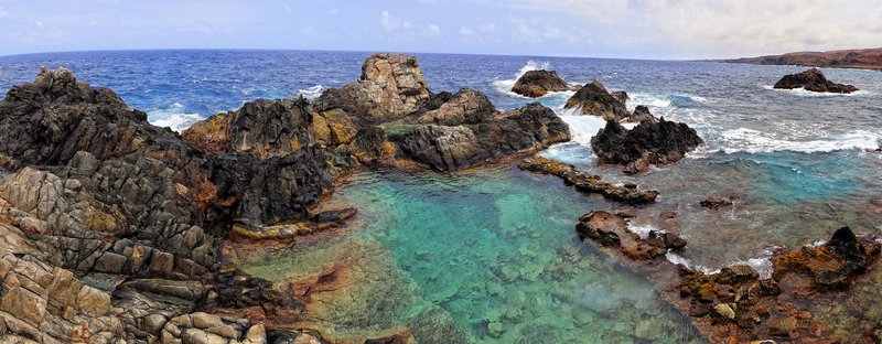
A sheltered seawater pool carved into the basalt of Aruba's wild north coast, reachable only by a rough 4WD track through Arikok National Park. Ocean swells surge in through rock crevices constantly refreshing the water, while the surrounding boulders act as a natural barrier against the open sea.
🏛️ Daily 8:00am - 3:30pm
⏰ ~1 hr
⚠️ 4WD vehicle required — accessible only via rough track inside Arikok National Park
🚕 40 min → hotel
From Hotel: 🚕 22 min → Bushiribana Gold Mill Ruins
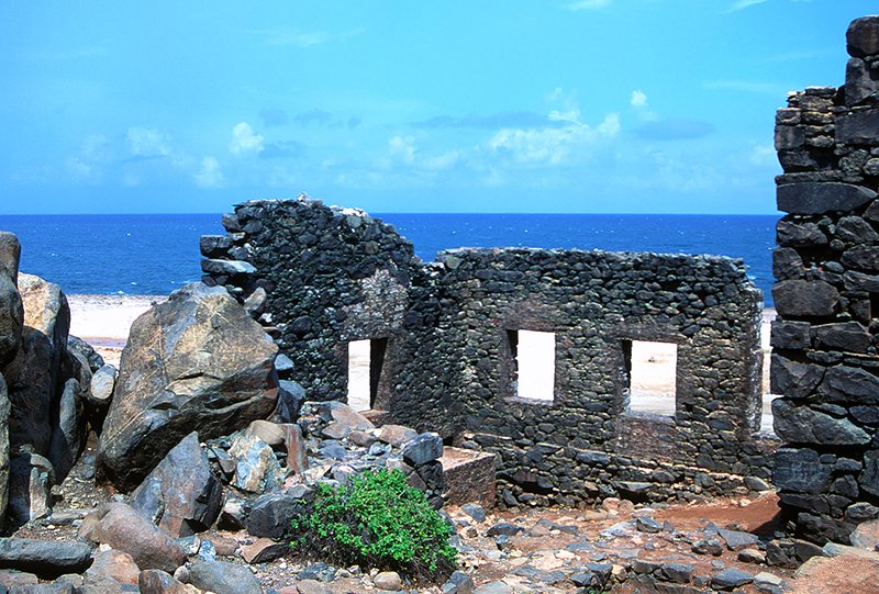
The roofless stone shell of a gold smelter built in 1825, perched on the jagged iron-black north coast where Atlantic surf pounds the limestone. Ore from nearby hills was processed here for a decade. The crumbling walls, sea spray and wild shoreline are among the island's most atmospheric.
🚕 18 min → Fontein Cave
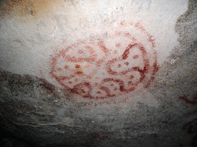
A limestone cave near Arikok's north gate with indigenous Arawak petroglyphs etched into the ceiling and walls — among the best-preserved pre-Columbian rock art in the Caribbean. Human figures and geometric forms survive alongside dripping stalactites. Entry via the Arikok day pass.
🏛️ Daily 8:00am - 4:00pm
⏰ ~45 min
⚠️ Entry included with Arikok National Park day pass
🚕 10 min → Quadirikiri Cave
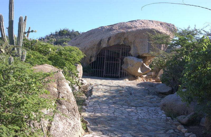
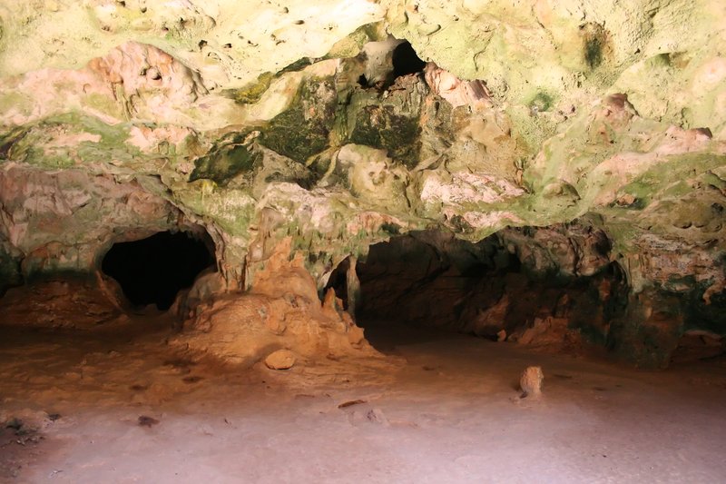
A limestone cave whose roof has collapsed in two places, creating dramatic circular skylights. Sunlight beams into the chamber, illuminating stalactites and the bat colony in the deepest section. A short passage connects to a second cave — entirely different in character from Fontein.
🏛️ Daily 8:00am - 4:00pm
⏰ ~30 min
⚠️ Entry included with Arikok National Park day pass
🚕 22 min → Balashi Gold Mill Ruins
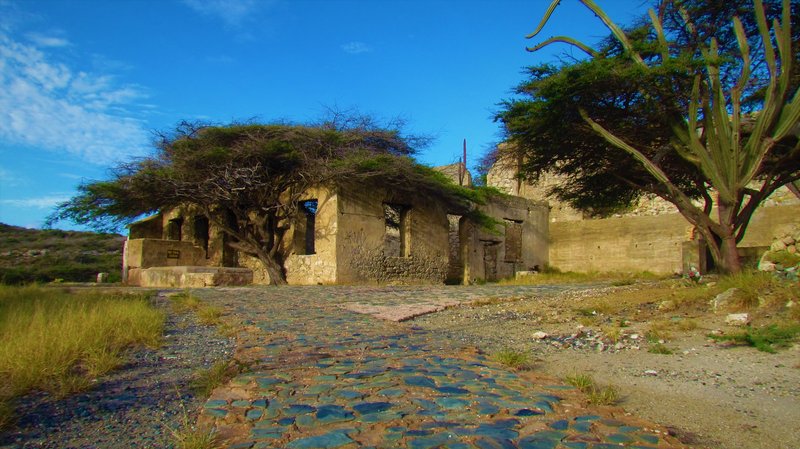
The ruins of a 19th-century gold smelter on Aruba's south coast — smaller and quieter than Bushiribana. The Aruba Gold Concession Company processed ore from the Balashi hills here in the 1870s. The roofless walls sit in flat scrubland between mangrove-fringed inlets.
🚕 20 min → hotel
🌵 The Island the Trade Winds Made
The Spanish arrived in Aruba in 1499 and dismissed it — along with Bonaire and Curaçao — as one of three islas inútiles, useless islands, because they found no gold. They were wrong about the gold, but the label stuck long enough to spare Aruba from the slave plantation economy that consumed most of the Caribbean. The island remained a backwater until the 1920s, when Venezuela's oil boom turned Aruba into one of the world's largest refinery sites almost overnight. That industrial chapter — the Eagle refinery, the Lago Colony, the waves of Venezuelan, Colombian and Dutch workers — is what shaped modern Aruba's peculiarly cosmopolitan character, where Papiamento blends Spanish, Portuguese, Dutch and English into a single compact island vernacular.
The divi-divi tree — Aruba's national symbol — grows only one way. No matter where on the island you encounter one, the trunk bends and the branches stream toward the southwest at a permanent angle of roughly 45 degrees. The culprit is the trade wind, which blows off the Atlantic at 25 miles per hour almost every day of the year without interruption. The same relentless breeze is why Aruba has almost no mosquitoes: the island is simply too windy for them to land. That perpetual air movement, combined with minimal rainfall and a flat, sun-washed terrain, places Aruba almost entirely outside the hurricane belt — a fact the divi-divi trees have been demonstrating, silently and emphatically, for centuries.